 Книжкові видання та компакт-диски  Журнали та продовжувані видання  Автореферати дисертацій  Реферативна база даних  Наукова періодика України  Тематичний навігатор  Авторитетний файл імен осіб
 |
Для швидкої роботи та реалізації всіх функціональних можливостей пошукової системи використовуйте браузер
"Mozilla Firefox" |
|
|
Повнотекстовий пошук
Пошуковий запит: (<.>I=Ж29144/2022/95<.>) |
Загальна кількість знайдених документів : 1
|
 |
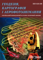
Geodesy, cartography and aerial photography : interdepartmental sci. and techn. rev..- Lviv- Title.
- Contents.
Geodesy
- Zablotskyi F., Kladochnyi B., Kutna I. Analysis of seasonal changes of zenith tropospheric delay components determined by the radio sounding and GNSS measurements data. - C. 5-12.
- Tretyak K., Zayats O., Hlotov V., Navodych M., Brusak I. Establishment of the automated system of geodetic monitoring for structures of Tereble-Ritska HPP. - C. 13-21.
- Vivat A., Petrov S., Volkova V. Development methods of large-equipment installation in design position using electronic total stations. - C. 22-30.
- Sossa B. Criteria for choosing test objects type for terrestrial laser scanners calibration. - C. 31-38.
- Burak K. On the accuracy of gravimetric provision of astronomo-geometric leveling on geodynamic and technogenic polygons. - C. 39-52.
Cartography and aerial photography
- Burshtynska K., Mazur A., Halochkin M., Shylo Y., Zayats I. Using images obtained from UAVs to construct a DEM of riverbed territories with complex hydromorphological characteristics. - C. 53-65.
- Galayda A., Chetverikov B., Kolb I. Methods of creaton a geoinformation online resource for governing a united territorial community. - C. 65-76.
- Kalynych I., Nychvyd M., Prodanets I., Kablak N., Vash Y. Monitoring of geodynamic processes in the Tysa river basin using AUTEL EVO II PRO RTK UAV. - C. 77-93.
- Sossa R., Yurkiv M. Cartometric investigation of the accuracy plan of Lviv in 1894. - C. 94-102.
- Kin D., Karpinskyi Y. The phenomenon of topological inconsistencies of frames of map sheets during the creation of the main state topographic map. - C. 103-112.
- Lazorenko N. Integration of geospatia l data based on the application of the JOIN operation of relative algebra. - C. 113-128.
- Malitskyi A. Modeling of quasisymmetric ring elements of the church using data of ground laser scanning. - C. 129-134.
Cadastr
- Hrytskiv N., Babiy L., Horyainova I. Research of spatial location sanitary protection zones of industrial enterprises using methods of geoinformation modeling. - C. 135-143.
| 2022 | | Iss. 95
|
|
|
|


